
Pyrenees III: Aneto
Climbing the highest mountain in the Pyrenees

Everyone loves to be the highest. Some would say I’m biased because I’m 6’7”, but having weaved through the circus crowds on Ben Nevis, the allure of the tallest mountains can’t be overlooked. With this in mind, I felt slightly uneasy about climbing Pico Aneto, the highest mountain in the Pyrenees. There are mountains that are far more iconic in the range, with better views and more interesting ascents. Despite this, the attraction of climbing the highest peak in the range made this the main goal this leg of my friend Andrew and I’s walk across the Pyrenees.
We arrived at the Renclusa refuge beneath Aneto in a fairly poor state. The day had already seen a very sketchy experience and had dragged along through a seemingly endless desolation. This was followed by a hideously narrow and bending path through the valley, which slowed progress further. For Andrew, it was even worse, as the hotel we stopped at didn’t have any gluten-free ice cream.
On arrival at the refuge, we had been met by the bleeding leg of a woman who had fallen on the mountain. This certainly concentrated minds, as we had had dinner with the same woman - a Czech walking blogger called Krstyna - days before in the valley of Anes Cruces. She had tried to cross the dry glacier and suffered some big bruising and a lot of scratches. In typical Central European fashion, she was going to push on and camp on a flat plain a few kilometres away as she continued her push to the Mediterranean.
Our planned camping spot was also filled with cows and their accompanying shit, so, more out of hope than expectation, we decided to ask if there was space in the refuge. Luckily for us, there was, and we settled in for dinner and an early start.
Renclusa is a busy refuge, but weirdly, despite this being mid-August, the hut was barely half full. The fairly standard wooden dining area and bunks aren’t worthy of much mention. As they always are, the guardians of the refuge were very useful, telling us that because of the glacier melting, we would have to take an alternative route to the summit. This involved almost no snow or ice, so the crampons and axes we had carried over the high mountains and passes before were merely extra weight. Aneto should be a glacier walk involving a long traverse over one of the Pyrenees’ largest glaciers. Climate change, however, is leading to the rapid disappearance of these frozen features that once defined its landscape. When we were there, the glaciers had lost all their snow and were “dry,” as the saying goes.
With everything ready for the next morning, we settled down for the refuge meal. This was typical Spanish refuge fare: a broth of very watery soup, some more hearty lentil soup, a salad, and then the pièce de résistance — some boiled mutton, the appearance of which suggested the sheep had been clubbed into pieces and then had the bones sifted out. Kidneys, lungs, brains, thighs, and everything in between were present, but needing to fuel ourselves for the next day’s exertions, we didn’t care.
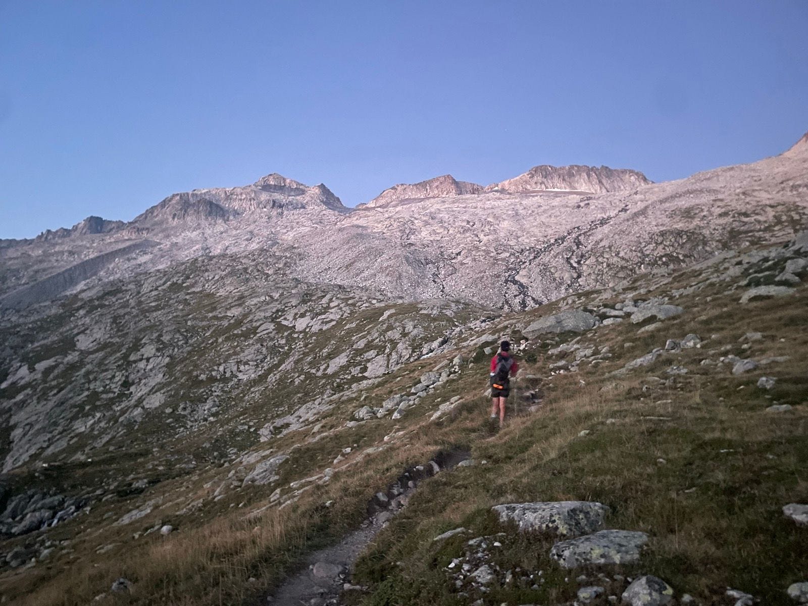
It was an alpine start, meaning we got up at 3:45 to leave at 4. Given the lack of snow, this probably wasn’t necessary, but it meant we spent less time in the sun, which we were thankful for. We had to pass through a maze of lights as walkers who had set out before us illuminated the hillside, all looking for the same junctions and paths. After about ten minutes, we were ahead of the others, and after twenty, we had left them behind for good. First of all, we are very fast and had multiple days of large exertion in the legs, so were used to the rhythm. Secondly, we had left our heavier items in the lockers at the refuge, so we were less encumbered than usual. And finally, I like to be faster than people, so the pace was pretty infernal at the start.
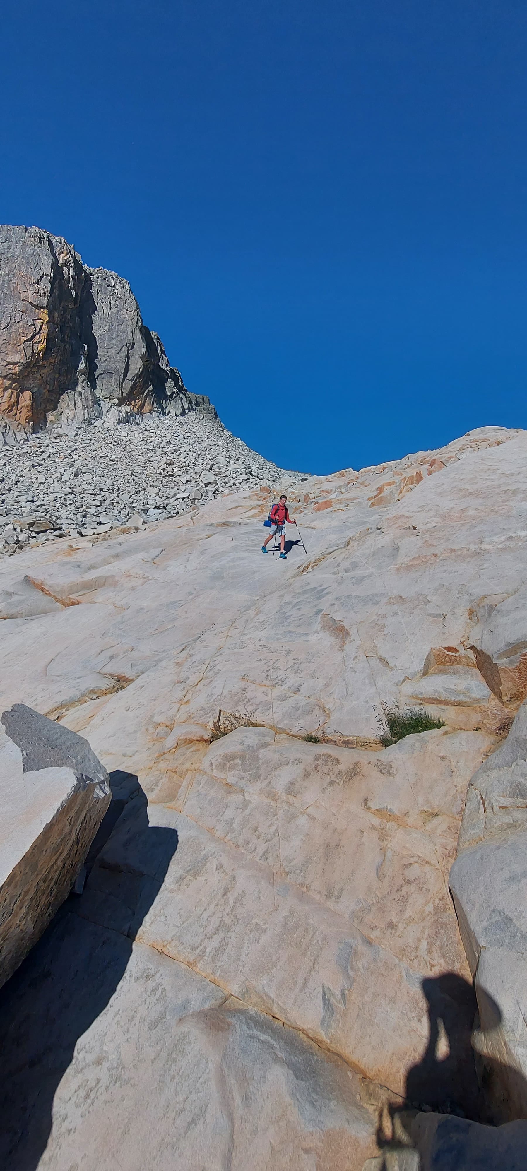
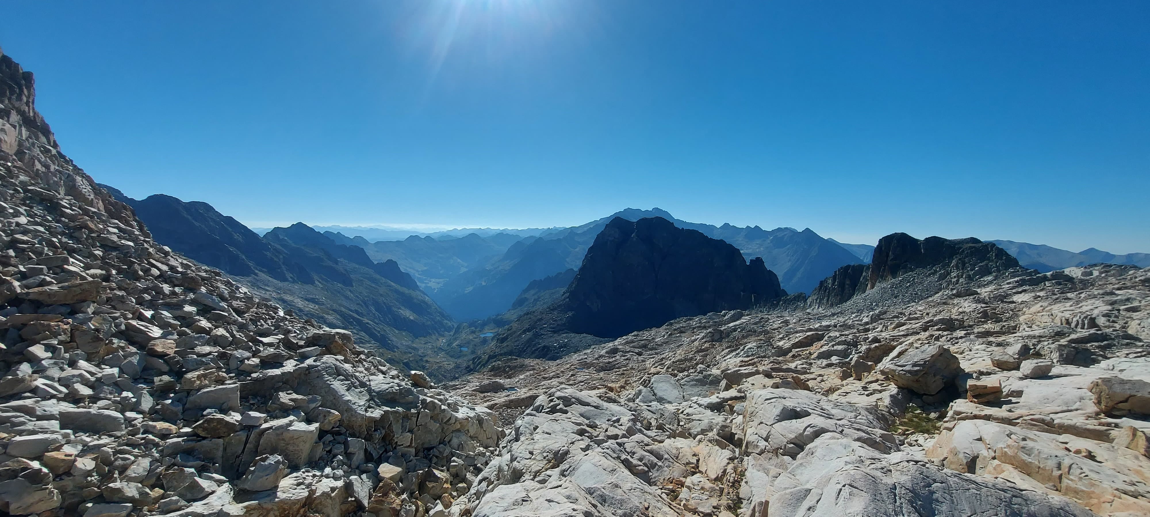
The climb is fairly easy over slabs and some grass, and this continues till you get to the more recently glaciated zone where the ice has left behind long-eroded slabs. There is no real path, but there are a few cairns to guide you towards the shoulder of Aneto near the Collado de Coronas. As you can see from the photos, there is not much to describe other than this gradual, very open ascent over rocks.


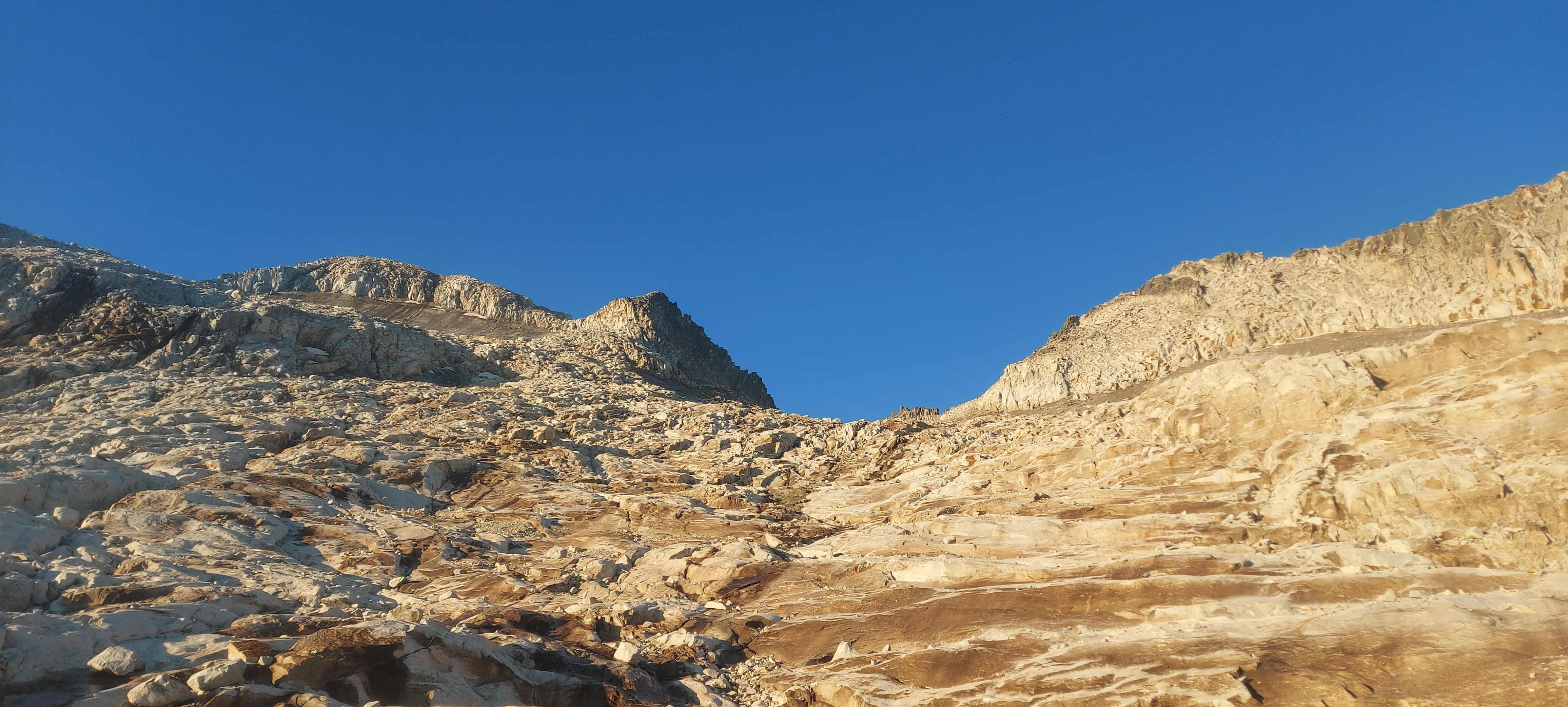
As we got closer to the Collado de Coronas, it became clear we would have to go round and up through a gully to access the summit. This involved some light scrambling over boulders till we found a gully we liked.


The entrance to the gully involved a few steps on snow, which once navigated, led to a few easy climbing moves. The only real danger was the loose rocks at the top of the gully, and once we were over, the walk was easy until the infamous Puente de Mahoma.


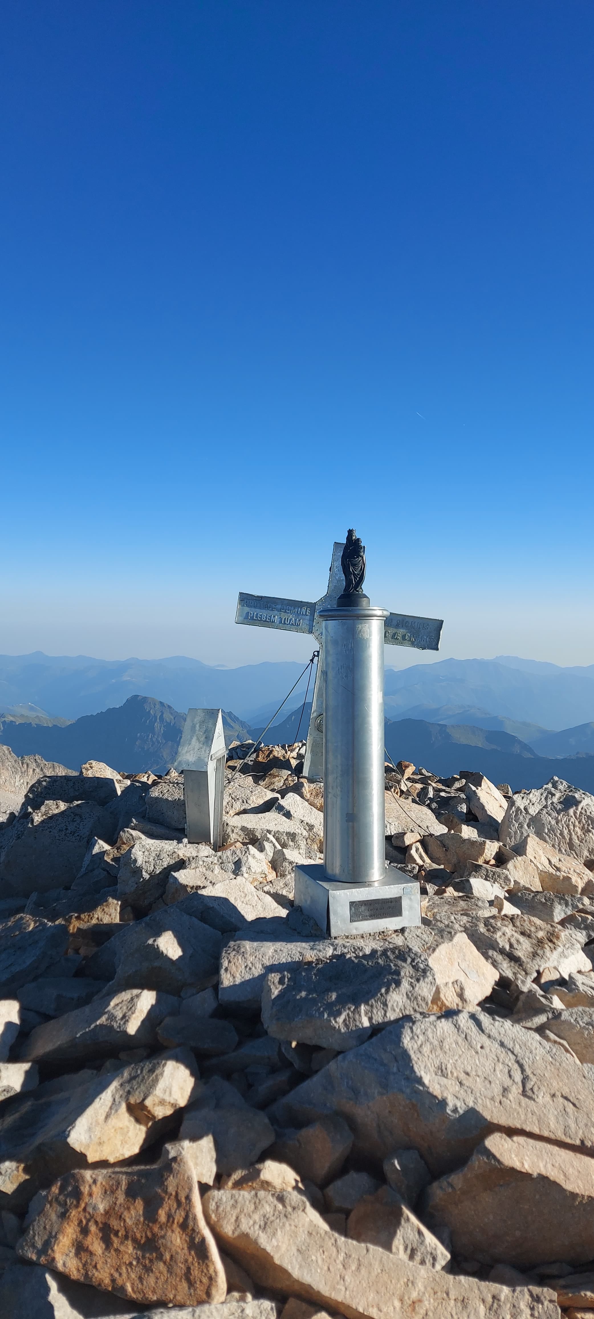
This is a not-very-difficult narrow scramble over a line of boulders to reach the summit. Andrew didn’t know this was coming, although I had told him before, so he was rather surprised. Despite the ease of the moves, the exposure is enormous, with thousand-metre drops on both sides, so it’s a place to take very seriously. Luckily, we were the first ones up that day, so didn’t have to deal with any crowds. The speed of our climb meant there was still frost on the rocks, which presented the only difficulty. After the last move of the Puente, you have reached the summit. It was a bit hazy, so the views weren’t that good, but it was a nice feeling to get to the top.
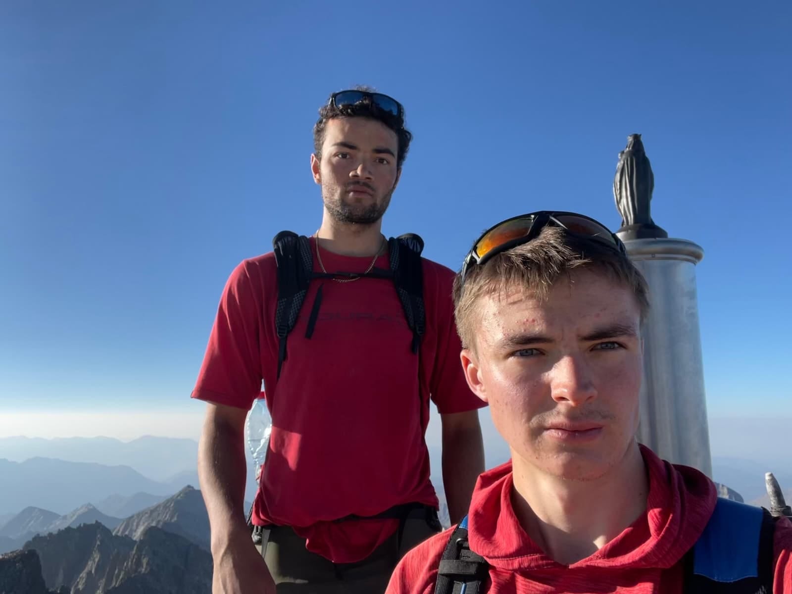
All the challenges I have just listed on the ascent had to be descended, although this was easier now we knew the way, andAndrew was doing this ascent off basically no food. On the way down, our egos gratefully absorbed the astonishment from those we found still ascending parts of the mountain we had climbed hours before. We did the entire walk from refuge to top and back in just over six hours total, including stops — barely half a day. We had met tens of people on the descent but had spent three hours of the ascent and time on the summit completely on our own.
After we had finally got to the bus and the town of Benasque, where we would resupply, the main goal of our trip had been completed. Aneto attracts a lot of walkers for being the highest in the range and is a hotspot for accidents. Nevertheless, despite it being a bit basic, it was nice to reach the highest point of the range. Andrew and I still, however, had many more miles to go.
Basic? Sounds more complicated without glaciers.